2021年12月29日水曜日

2021年12月27日、米カリフォーニア州、LearJet 35A、死亡4名

今年最後の事故になっていればよいですね。Aviation Safety Networkの投稿内容をお伝えしています。

Date:Monday 27 December 2021
Time:19:14
Type:Silhouette image of generic LJ35 model; specific model in this crash may look slightly different
Learjet 35A
Operator:Med Jet
Registration:N880Z
MSN:35A-591
First flight:1985
Crew:Fatalities: / Occupants:
Passengers:Fatalities: / Occupants:
Total:Fatalities: 4 / Occupants: 4
Aircraft damage:Destroyed
Aircraft fate:Written off (damaged beyond repair)
Location:El Cajon, San Diego (   United States of America)
Phase:Approach (APR)
Nature:Unknown
Departure airport:Santa Ana-John Wayne International Airport, CA (SNA/KSNA), United States of America
Destination airport:San Diego-Gillespie Field, CA (SEE/KSEE), United States of America
Narrative:

リアジェット35Aが住宅地に墜落し、機内の全員が死亡した。同機はカリフォーニア州サンディエゴ-ギレスピフィールドの滑走路27Rへの最終アプローチに入っていたが、滑走路から2.6km東のサンディエゴ・エルカジョンの住宅地に墜落し炎上した。

現地時間19:08にギレスピタワーが17滑走路への着陸を許可していた。 19:11に同機からギレスピタワーに連絡が入り、IFRクリアランスを取り消し、27Rへの着陸を要請してきた。これは承認され、タワー管制官は滑走路27Rへのアプローチを許可した。乗員から滑走路照明の点灯の要請があり、管制官は「100%点灯中」と返答した。

Sources:
» kusi.com
» FAA

METAR Weather report:
02:55 UTC / 18:55 local time:
KSEE 280255Z VRB05KT 3SM BR BKN020 OVC026 10/08 A2998

03:55 UTC / 19:55 local time:
KSEE 280355Z VRB05KT 3SM BR SCT011 BKN020 11/09 A2996


Photos

photo of Learjet-35A-N880Z
 

Video, social media

Map
This map shows the airport of departure and the intended destination of the flight. The line is connecting ADS-B datapoints from AX.
Distance from Santa Ana-John Wayne International Airport, CA to San Diego-Gillespie Field, CA as the crow flies is 125 km (78 miles).
Accident location: Exact; deduced from official accident report.

This information is not presented as the Flight Safety Foundation or the Aviation Safety Network’s opinion as to the cause of the accident. It is preliminary and is based on the facts as they are known at this time.

2021年12月24日金曜日

2021年12月3日、コンゴ民主共和国、ショーツ360-300、5名死亡


Date:Thursday 23 December 2021
Type:Silhouette image of generic SH36 model; specific model in this crash may look slightly different
Shorts 360-300
Operator:Malu Aviation
Registration:9S-GPS
MSN:SH.3752
First flight:1989-02-09 (32 years 11 months)
Engines:Pratt & Whitney Canada PT6A-67R
Crew:Fatalities: 3 / Occupants: 3
Passengers:Fatalities: 2 / Occupants: 2
Total:Fatalities: 5 / Occupants: 5
Aircraft damage:Damaged beyond repair
Location:14,8 km (9.3 mls) from Shabunda (   Democratic Republic of the Congo)
Phase:Unknown (UNK)
Nature:Cargo
Departure airport:Goma Airport (GOM/FZNA), Democratic Republic of the Congo
Destination airport:Shabunda Airport (FZMW), Democratic Republic of the Congo

Narrative:
A Malu Aviation Shorts 360-300 is reported to have crashed in D.R. Congo, killing all five on board.

マルエイビエーション運航のショーツ360-300がコンゴ民主共和国で墜落し、機内5名全員が死亡したとの一報が入ってきた。

Sources:

» drcactu.cd


Photos


Add your photo of this accident or aircraft

Aircraft history
dateregistrationoperatorremarks
9 February 1989G-BPKVShort Brothersfirst flight
23 April 1989G-BPKVRheinland Air Service
5 December 1990D-CAASRheinland Air Servicebought
1 March 1996D-CAASRAS Fluggesellschaft
11 July 1996VH-SULSunstate Airlinesbought
November 2001VH-SULSunstate Airlineswithdrawn from use, Brisbane
24 October 2003N136LRAir Cargo Carriersbought
6 September 20139Q-CPSMalu Aviation
unknown9S-GPSMalu Aviationre-registered

Map
This map shows the airport of departure and the intended destination of the flight. The line between the airports does not display the exact flight path.
Distance from Goma Airport to Shabunda Airport as the crow flies is 239 km (149 miles).

2021年12月18日土曜日

2021年12月15日、ドミニカ共和国、ガルフストリームG-IVSP、9名死亡

航空事故統計をまとめるAviationSafetyNetworkから毎回ご紹介しています。


Date:Wednesday 15 December 2021
Time:c. 21:22 UTC
Type:Silhouette image of generic GLF4 model; specific model in this crash may look slightly different
Gulfstream G-IVSP
Operator:Helidosa Aviation Group
Registration:HI1050
MSN:1482
First flight:2002
Crew:Fatalities: 3 / Occupants: 3
Passengers:Fatalities: 6 / Occupants: 6
Total:Fatalities: 9 / Occupants: 9
Aircraft damage:Destroyed
Aircraft fate:Written off (damaged beyond repair)
Location:Santo Domingo-Las Américas International Airport (SDQ) (   Dominican Republic)
Phase:Landing (LDG)
Nature:
Departure airport:Higuero/La Isabela-Dr. Joaquín Balaguer Airport (JBQ/MDJB), Dominican Republic
Destination airport:Orlando International Airport, FL (MCO/KMCO), United States of America

Narrative:

ガルフストリームG-IVSP登録番号HI1050がサントドミンゴ-アメリカス国際空港 (SDQ/MDSD)(ドミニカ共和国)で事故に遭遇し全損扱いとなった。初期情報によれば同機のパイロットからヒゲロを離陸直後に内容不明の問題が発生したためサントドミンゴへの目的変更を伝えてきたとある。同機は墜落後に炎上した。パイロット二名、フライトアテンダント1名、乗客6名が全員死亡した。

Sources:

» telemundo47.com
» cnn.com


Photos


photo of Gulfstream-G-IVSP-HI1050
 

Video, social media

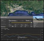
Map
This map shows the airport of departure and the intended destination of the flight. The line is connecting ADS-B datapoints from Flightradar24.
Distance from Higuero/La Isabela-Dr. Joaquín Balaguer Airport to Orlando International Airport, FL as the crow flies is 1581 km (988 miles).
Accident location: Approximate; accuracy within a few kilometers.

This information is not presented as the Flight Safety Foundation or the Aviation Safety Network’s opinion as to the cause of the accident. It is preliminary and is based on the facts as they are known at this time.

2021年12月12日日曜日

2021年12月10日、ニューハンプシャー州、スウェリンジェン・マーリンIV、1名死亡

航空事故統計をまとめるFlght Safety Foundationのサイトからご紹介しています。


Date:Friday 10 December 2021
Time:23:30
Type:Silhouette image of generic SW4 model; specific model in this crash may look slightly different
Swearingen SA-226AT Merlin IV
Operator:Castle Aviation
Registration:N54GP
MSN:AT-034
First flight:1975
Crew:Fatalities: 1 / Occupants: 1
Passengers:Fatalities: 0 / Occupants: 0
Total:Fatalities: 1 / Occupants: 1
Aircraft damage:Destroyed
Aircraft fate:Written off (damaged beyond repair)
Location:0,6 km (0.4 mls) SW of Manchester-Boston Regional Airport, NH (MHT) (   United States of America)
Phase:Approach (APR)
Nature:Cargo
Departure airport:Caldwell Wright Airport, NJ (CDW/KCDW), United States of America
Destination airport:Manchester-Boston Regional Airport, NH (MHT/KMHT), United States of America
Flightnumber:CSJ921
Narrative:
Castle Aviation flight CSJ921, a Swearingen SA-226AT Merlin IV, N54GP, was destroyed when it crashed into the bank of the Merimack River, about 600 m short of the threshold of runway 6 at Manchester–Boston Regional Airport, NH (MHT), New Hampshire, USA. The sole pilot onboard was fatally injured.
Preliminary information indicates the pilot reported an engine failure on final approach.
キャッスルエイビエーションのCSJ921便(スウェリンジェンSA-226ATマーリンIV)(登録番号N54GP)がニューハンプシャー州マンチェスター・ボストン地方空港のランウェイ6手前600メートル地点でメリマック川の堤に激突し全損事故となった。機内にはパイロット一名のみ搭乗しており、死亡が確認された。初期情報だが同パイロットから最終アプローチ中にエンジン不調の報告があったという。

Sources:
» wmur.com
» Flightaware Flight track
» ADSBexchange flight track

METAR Weather report:
04:21 UTC / 23:21 local time:
SPECI KMHT 110421Z 00000KT 10SM BKN017 OVC075 M02/M05 A3016
time 0421Z, wind calm, visibility 10 statute miles, broken 1,700, overcast 7,500


Photos

Add your photo of this accident or aircraft

Video, social media

Map
This map shows the airport of departure and the intended destination of the flight. The line is connecting ADS-B datapoints from AX.
Distance from Caldwell Wright Airport, NJ to Manchester-Boston Regional Airport, NH as the crow flies is 326 km (204 miles).
Accident location: Approximate; accuracy within a few kilometers.

This information is not presented as the Flight Safety Foundation or the Aviation Safety Network’s opinion as to the cause of the accident. It is preliminary and is based on the facts as they are known at this time.

2021年11月16日火曜日

2021年11日13日ミシガン州、ブリティッシュノーマンBN-2、 4名死亡


Status:Preliminary
Date:Saturday 13 November 2021
Time:c. 13:45
Type:Silhouette image of generic BN2P model; specific model in this crash may look slightly different
Britten-Norman BN-2A-6 Islander
Operator:Island Airways
Registration:N866JA
MSN:185
First flight:1970
Crew:Fatalities: 1 / Occupants: 1
Passengers:Fatalities: 3 / Occupants: 4
Total:Fatalities: 4 / Occupants: 5
Aircraft damage:Damaged beyond repair
Location:Beaver Island, MI (   United States of America)
Phase:Unknown (UNK)
Nature:Passenger
Departure airport:Charlevoix Municipal Airport, MI (KCVX), United States of America
Destination airport:Beaver Island-Welke Airport, MI, United States of America
Narrative:

ブリティッシュ‐ノーマンBN-2Aアイランダー機がミシガン州ビーバーアイランドで大破した。乗客のうち一名が重傷を負ったものの生還した。同機はチャーるヴォックスヴォアックス市営空港(ミシガン)を現地時間13:32時に離陸した。同空港の天候条件は南西に風4マイルで高度1800フィートに部分的雲があり、13:35時にこれが700フィートまで下がりその後30分間続き、ときおり降雪突風があった。

Sources:
» petoskeynews.com

METAR Weather report:
18:15 UTC / 13:15 local time:
KSJX 131815Z AUTO 32011G15KT 10SM SCT013 SCT019 BKN037 05/00 A2973 RMK AO2 T00510003

18:35 UTC / 13:35 local time:
KSJX 131835Z AUTO 33010G19KT 5SM -SN SCT018 SCT022 BKN028 03/00 A2974 RMK AO2 T00330003

18:55 UTC / 13:55 local time:
METAR KSJX 131855Z AUTO 32011G20KT 10SM SCT020 SCT030 SCT038 04/00 A2973

19:15 UTC / 14:15 local time:
METAR KSJX 131915Z AUTO 31005G16KT 4SM -SN SCT007 SCT018 BKN044 03/01 A2974


Photos

Add your photo of this accident or aircraft

Map
This map shows the airport of departure and the intended destination of the flight. The line between the airports does not display the exact flight path.
Distance from Charlevoix Municipal Airport, MI to Beaver Island-Welke Airport, MI as the crow flies is 50 km (31 miles).

2021年11月6日土曜日

2021年11月3日、ロシア、アントノフAn-12 、9名死亡


Date:Wednesday 3 November 2021
Time:19:34
Type:Silhouette image of generic AN12 model; specific model in this crash may look slightly different
Antonov An-12BK
Operator:Grodno Aircompany
Registration:EW-518TI
MSN:8346107
First flight:1968
Crew:Fatalities: 7 / Occupants: 7
Passengers:Fatalities: 2 / Occupants: 2
Total:Fatalities: 9 / Occupants: 9
Aircraft damage:Destroyed
Aircraft fate:Written off (damaged beyond repair)
Location:ca 3 km SE of Irkutsk Airport (IKT) (   Russia)
Phase:Approach (APR)
Nature:Ferry/positioning
Departure airport:Yakutsk Airport (YKS/UEEE), Russia
Destination airport:Irkutsk Airport (IKT/UIII), Russia
Narrative:

アントノフAn-12がロシア、イルクーツク空港の東側森林地帯に墜落し、機内9名全員が死亡した。墜落後火災が発生した。

同機は糧食ほか消費財をチュコトカ自治区のアナディルからの輸送にあたっており、ヤクーツクに戻る途中だった。イルクーツク空港へのアプローチで搭乗員からゴーアラウンドすると連絡が入ったあとに墜落した。事故当時の天候は降雪のため悪化し、雲が低高度にあった。視界が悪く気温は-7°Cだった。

Sources:
» rt.com
» 38.mchs.gov.ru
» favt.gov.ru
» mintrans.gov.by
» caa.gov.by

METAR Weather report:
11:00 UTC / 19:00 local time:
UIII 031100Z 30008MPS 5000 -SHSN OVC012CB M06/M08 Q1008 RESHSN R30/450250 NOSIG RMK QFE711/0949

11:30 UTC / 19:30 local time:
UIII 031130Z 29008MPS 0800 R30/1700 +SHSN OVC007CB M07/M08 Q1009 R30/450250 NOSIG RMK QBB220 QFE712/0950

12:00 UTC / 20:00 local time:
UIII 031200Z 29008MPS 0700 0550NW R30/1600 +SHSN OVC006CB M07/M08 Q1009 R30/450250 NOSIG RMK QBB200 QFE713/0950


Photos

photo of Antonov-An-12BK-EW-518TI
accident date: 03-11-2021
type: Antonov An-12BK
registration: EW-518TI
 

Map
This map shows the airport of departure and the intended destination of the flight. The line between the airports does not display the exact flight path.
Distance from Yakutsk Airport to Irkutsk Airport as the crow flies is 1846 km (1154 miles).
Accident location: Approximate; accuracy within a few kilometers.

This information is not presented as the Flight Safety Foundation or the Aviation Safety Network’s opinion as to the cause of the accident. It is preliminary and is based on the facts as they are known at this time.

2025年7月24日、ロシア、An-24、死亡49名

  アンガラ航空2G-2311便(アントノフAn-24RV)はロシアのティンダ空港(TYD)近くの森林に墜落した。49人が搭乗していた。 同機はハバロフスク発ブラゴヴェシチェンスク(BQS)およびティンダ(TYD)行きの便で運航されていた。 フライトは現地時間11時21分にBQS...